

Rangelands Monitoring Tool app for iPhone and iPad
Developer: Gascoyne Catchments Group Inc
First release : 03 Mar 2019
App size: 44.88 Mb
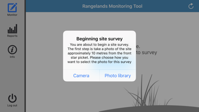
The Rangelands Monitoring Tool is an application that allows pastoralists to conduct a self-assessment of their rangelands and report it back to a central repository.
It is a process of rangeland assessment that provides: perennial shrub and grass trends to monitor pasture composition and trends in range condition; monitoring for soil health, stability, infiltration rates and nutrient cycling; a method to record and assess the type and severity of rangeland erosion, and improved short term management decision on pastoral leases
The app uses a value-based approach, which removes any subjective conclusions to rangelands trends and provides a generic methodology that can be utilized by landholders.
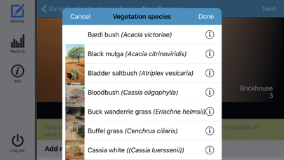
The system classifies three components of rangeland health: Plants with each species nominated a value between 1 and 10 based on its environmental and commercial values; Soils with four soil attributes nominated a value between 1 and 10 based on their contribution to soil stability, nutrient cycling, and infiltration rates; Erosion with three main types of erosion given a negative value between 0 and -10 based on their adverse impacts on soil stability, infiltration rates and nutrient cycling.
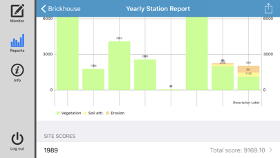
The values when applied in the app, generate a Site Stability Index (SSI) which then becomes a benchmark for change in the site, land system, property or catchment.
Four different types of reports are capable of being produced from a property perspective.
Site report – allows you to see a graph on all historical SSIs for that specific site over the years and then drill down into each survey to see how it achieved that SSI.
Vegetation species report – by selecting a site you can then choose the vegetation species that you want to inquire about.
Land systems report – this report shows you a graph of what the SSI has been for the site over all the surveyed years.
Station report – the station report shows all the sites surveyed over the property within their SSI.